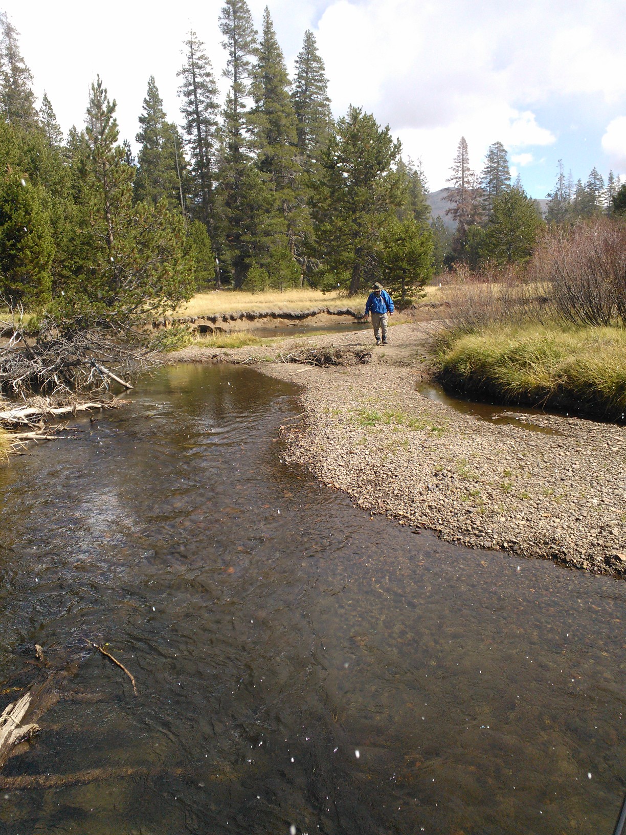
Caples Creek was listed as a California Fish and Wildlife Wild Trout Water in about 2016. It is an attractive free flowing stream located mostly remotely from roadways. It is a pleasant place to visit, hike and fish. The Fish and Wildlife Department has revised the regulation of the creek to make it no take, catch and release only, i.e.; winter rules apply year round. Unfortunately the fish population is small in numbers. Rainbow trout are prominent in the lower section while Brook trout inhabit the upper section. The middle section is unknown. Our El Dorado chapter desires to enhance the fishery by increasing the fish population through analysis, habitat improvement, stocking or hatching in-situ.

A limited set of angler surveys have been performed to determine angler success and fish density on Caples Creek. Surveys have not been beneficial as few anglers have been encountered at the trailheads. Readers are encouraged to fish Caples Creek and report their success on the Contact Us page. Favorite spots will not be revealed.
| Live Fish | Carcasses | Redds | |||||||||||||||||
| Tributary/ ID | Description | 2015 | 2014 | 2013 | 2012 | 2011 | 2010 | 2015 | 2014 | 2013 | 2012 | 2011 | 2010 | 2015 | 2014 | 2013 | 2012 | 2011 | 2010 |
| Secret Ravine | |||||||||||||||||||
| SR1 | Confluence to E. Rsvl Pkwy | 3 | 24 | 0 | 21 | 0 | 0 | 0 | 10 | 0 | 5 | 0 | 2 | 3 | 11 | 2 | 21 | 0 | 0 |
| SR2 | E. Rsvl Pkwy to China Garden | 20 | 220 | 15 | 120 | 12 | 25 | 3 | 34 | 7 | 40 | 2 | 11 | 42 | 168 | 3 | 68 | 20 | 30 |
| SR3 | China Garden to Rocklin Rd. | 42 | 0 | 20 | 6 | 1 | 1 | 18 | 0 | 1 | |||||||||
| SR4 | Rocklin Rd to Sierra College Blvd | 1 | 7 | 0 | 0 | 0 | 0 | ||||||||||||
| SR41 | Sierra College Blvd to Brace Rd | 0 | 0 | 0 | 0 | 0 | 1 | ||||||||||||
| SR4b | Brace Rd to Loomis Basin Pk | ||||||||||||||||||
| SR5 | Loomis Basin Park | ||||||||||||||||||
| 24 | 286 | 15 | 168 | 12 | 25 | 3 | 50 | 8 | 46 | 2 | 13 | 45 | 197 | 5 | 90 | 21 | 30 | ||
| Miners Ravine | |||||||||||||||||||
| MR1 | Confluence to E. Rsvl Pkwy Bridge. | 15 | 0 | 0 | 0 | 0 | 8 | 0 | 1 | 0 | 2 | 10 | 0 | 1 | 0 | 3 | |||
| MR2 | E. Rsvl Pkwy to Sierra College Blvd | 0 | 4 | 0 | 0 | 0 | |||||||||||||
| 15 | 0 | 4 | 0 | 0 | 8 | 0 | 1 | 0 | 2 | 10 | 0 | 1 | 0 | 3 | |||||
| Antelope | |||||||||||||||||||
| AC1 | Confluence to culverts | 5 | 0 | 0 | 0 | 0 | 2 | 1 | 2 | 0 | 0 | 1 | 15 | ||||||
| AC2 | Culverts to Rsvl Pkwy | 0 | 0 | ||||||||||||||||
| 5 | 0 | 0 | 0 | 0 | 0 | 2 | 1 | 2 | 0 | 0 | 0 | 1 | 15 | 0 | |||||
| Linda/ Cirby | |||||||||||||||||||
| LC1 | Confluence to Sunrise | 0 | 0 | 0 | 0 | 0 | 0 | 7 | |||||||||||
| LC2 | Sunrise to Rocky Ridge | ||||||||||||||||||
| LC3 | Rocky Ridge to Old Auburn | ||||||||||||||||||
| LC4 | Old Auburn to Hazel | ||||||||||||||||||
| 0 | 0 | 0 | 0 | 0 | 0 | 0 | 0 | 0 | 7 | 0 | 0 | ||||||||
| Dry Creek | |||||||||||||||||||
| MS1 | Atkinson to Vernon | 5 | 0 | 1 | |||||||||||||||
| MS2 | Vernon to Riverside | 0 | |||||||||||||||||
| MS3 | Riverside to Douglas | 7 | 14 | 101 | 4 | 2 | 0 | 0 | 2 | 17 | 3 | 1 | |||||||
| MS4 | Douglas to Folsom | 0 | 20 | 0 | 0 | 0 | 6 | 0 | 7 | 5 | 3 | 0 | |||||||
| MS5 | Folsom to Harding | 6 | 14 | 17 | 0 | 0 | 0 | 5 | 1 | 5 | 8 | 3 | 2 | ||||||
| MS6 | Harding to SR/MR confluence | 5 | 42 | 17 | 16 | 0 | 3 | 1 | 11 | 4 | 0 | 0 | 3 | 2 | 8 | 10 | 7 | 2 | 4 |
| 5 | 48 | 38 | 55 | 101 | 24 | 1 | 11 | 6 | 0 | 11 | 6 | 2 | 13 | 42 | 16 | 8 | 7 | ||
| Dry Creek Watershed Annual Totals (1) | 29 | 196 | 38 | 227 | 113 | 49 | 4 | 69 | 16 | 48 | 15 | 21 | 47 | 220 | 47 | 115 | 44 | 40 | |
The Forest Service has invited El Dorado TU to participate ion the Woods Lake Access Project they have in process. We joined with the Forest Service to pledge support for this project in early spring. The contractor for bridge construction and culvert removal has been selected, and work is likely to begin on construction of the bridge abutments in the next couple of weeks. The culvert won't be removed until the bridge can be used, and then the stream banks will be restored to meet the existing streambank shape. We have been asked to plant native vegetation and willow cuttings along the streambank of the east fork of Woods Lake Creek when the heavier construction is complete. Expected date for planting is the end of September or early October.
The Woods Lake Recreation Area Access project is located in the Eldorado National Forest in Alpine County, Northern California, with access from Highway 88 approximately 2 miles west of Carson Pass. The landscape is the western crest of the Sierra Nevada mountain range, at an elevation of approximately 8,350 feet in an area that is primarily sub-alpine forest on National Forest System (NFS) lands. The overall climate is a Mediterranean subtype with warm dry summers and cool moist winters. Most of the precipitation falls as snow between October and April, with occasional summer thunderstorms.
The Woods Lake campground, picnic area, and trailhead are popular destinations. The existing access road includes a culvert over the east fork of Woods Lake Creek that is mis-aligned, undersized, and losing structural integrity. In addition, the turn onto this road for recreation site access is sharper than a 90-degree angle, which makes it difficult for larger vehicles to make the turn safely before the culvert crossing. Along with the sharp turn and the misalignment, the culvert has been overtopped and eroded the road to a narrower width over the culvert compared to the rest of the road, making it more difficult for many recreational vehicles to cross. There is a straight drop-off of about 5 ft. into the creek, with no guardrail, and several vehicles have become stuck while attempting to negotiate this sharp turn and eroded culvert stream crossing. A serious public safety concern exists, and further deterioration could result in the closure of the Woods Lake Recreation Area.
The El Dorado Board has selected a Monofilament Collection Bin as its first conservation project. The bin would be assembled in large numbers for installation throughout the county. The bins would be placed at convenient stream side locations where fishing traffic would pass. Locations would include boat ramps, trail heads or other fishery gathering spots. Ron Zigelhofer, our president, has assembled a prototype as seen in the images. We will analyze and refine the design and then built units for installation. A project team will be assembled to critique the design, estimate the number of units to be installed, procure materials, build units, gain approval for installation, procure stickers and accomplish installation. Sign-up on the home page if you can contribute to this project.
Trout Unlimited El Dorado has no conservation projects in work at the present time. Being newly formed we are exploring our county to define areas which require attention to improve or restore habitat.